1
/
van
1
mysite
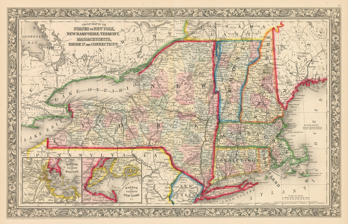
1862 County Map of the States of New York, New Hampshire, Vermont, Massachusetts, Rhode Island, and Connecticut
1862 County Map of the States of New York, New Hampshire, Vermont, Massachusetts, Rhode Island, and Connecticut
Normale prijs
£289.00 GBP
Normale prijs
£294.00 GBP
Aanbiedingsprijs
£289.00 GBP
Belastingen inbegrepen.
Verzendkosten worden berekend bij de checkout.
Aantal
Kan beschikbaarheid voor afhalen niet laden
By: Samuel Augustus Mitchell Jr.
Date of Original: 1856 (published)?Philadelphia
Original Size: 14 x 17 inches (35.5 x 43.2 cm)
This is a fine print reproduction of a map of New Hampshire, published by?Samuel A. Mitchell Jr. out of?Philadelphia in 1862. The map is color coded by county with townships also identified and shows railroads, common roads, rivers, canals, mountains, lakes, large towns and villages of the mid-19th century. The map includes two inset maps of the Harbor and Vicinity of Boston and New York.?
Inventory #NA15-3
Share