mysite
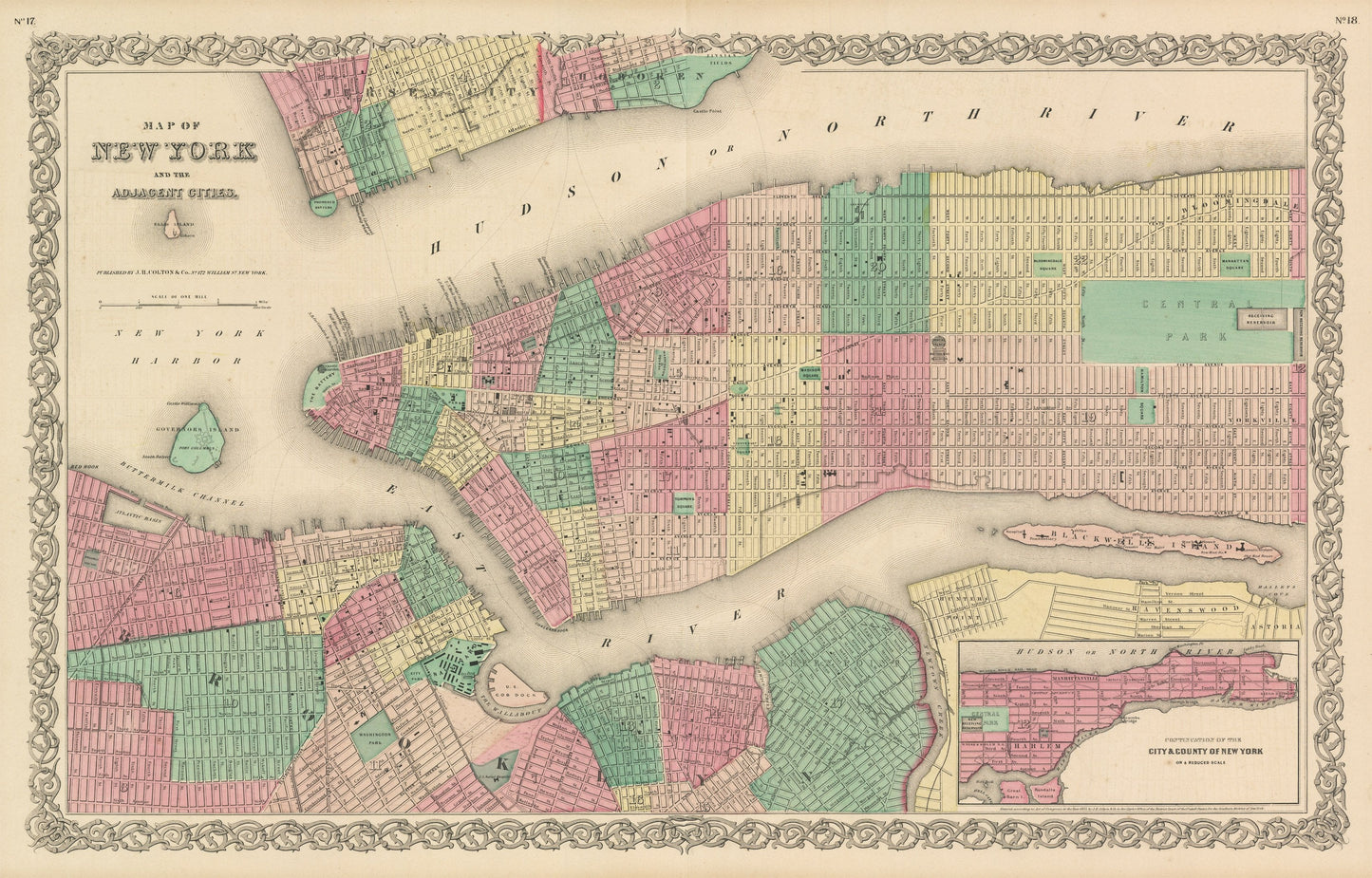
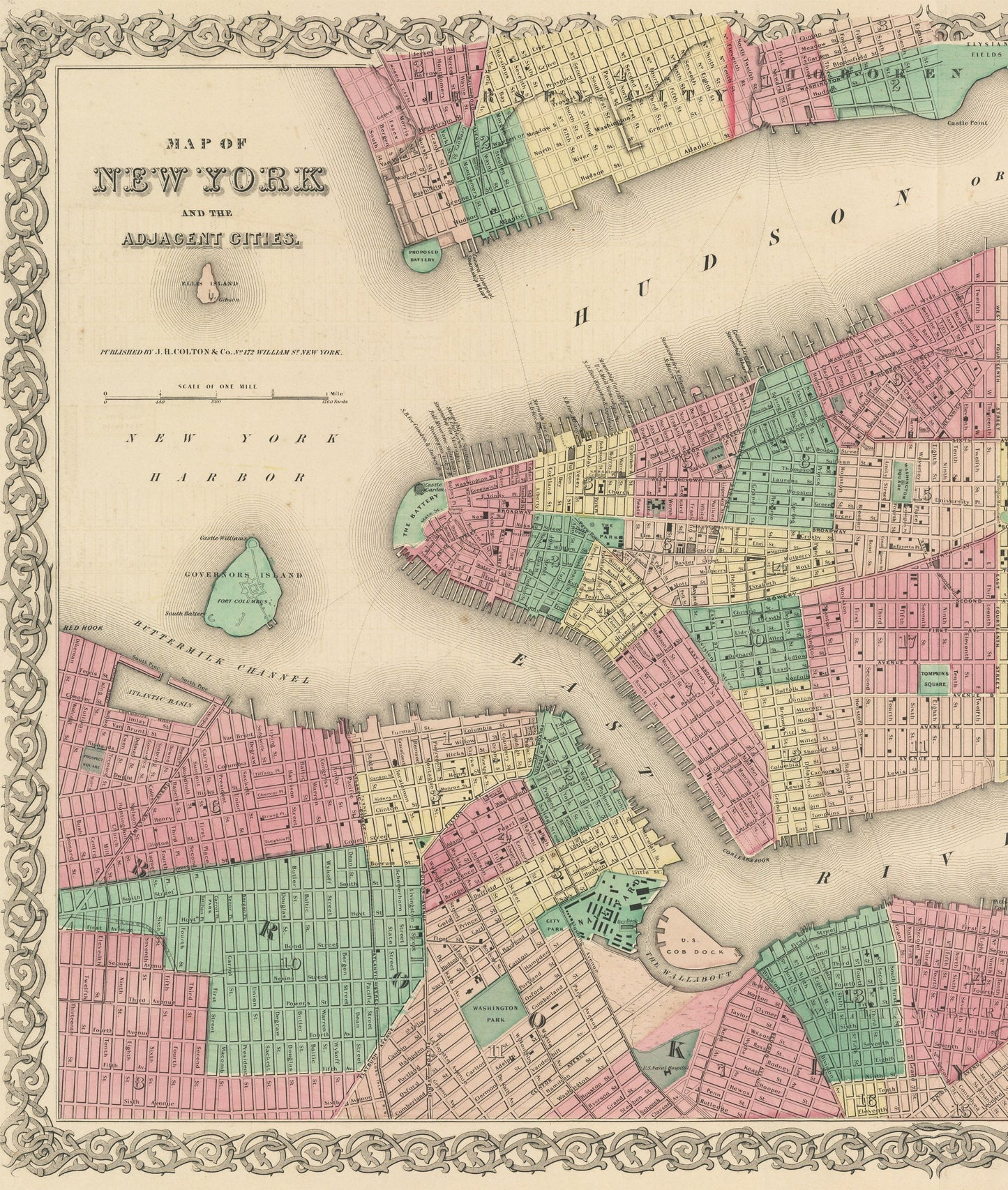
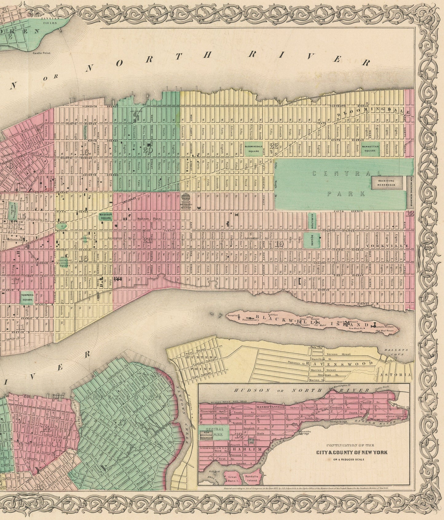
1856 Map of New York and the Adjacent Cities
1856 Map of New York and the Adjacent Cities
Kan beschikbaarheid voor afhalen niet laden
By: Joseph H. Colton
Date of Original: 1856 (published) New York
Original Size:?17 x?27 inches (43?x?68.5 cm)
This is a fine print reproduction of a map of New York City, centered on Manhattan with parts of Hoboken, Jersey City, Brooklyn?published by Joseph H. Colton out of New York in 1856. The map is color coded by wards and shows streets, parks, squares, ferry routes, government buildings, and land reclamation projects both recently completed and planned for the future.
The map features the world famous Central Park, which had been approved by the city but not yet developed and would not open to the public for two years (in 1858). Other noteworthy landmarks include Ellis Island, Fort Columbus on Governor's Island, a penitentiary, lunatic asylum, and the Naval Yard. An inset in the lower right shows the northern portion of Manhattan, also known as the Harlem neighborhood.
Inventory #NA116
Share