1
/
van
1
mysite
1856 Louisiana
1856 Louisiana
Normale prijs
£289.00 GBP
Normale prijs
£294.00 GBP
Aanbiedingsprijs
£289.00 GBP
Belastingen inbegrepen.
Verzendkosten worden berekend bij de checkout.
Aantal
Kan beschikbaarheid voor afhalen niet laden
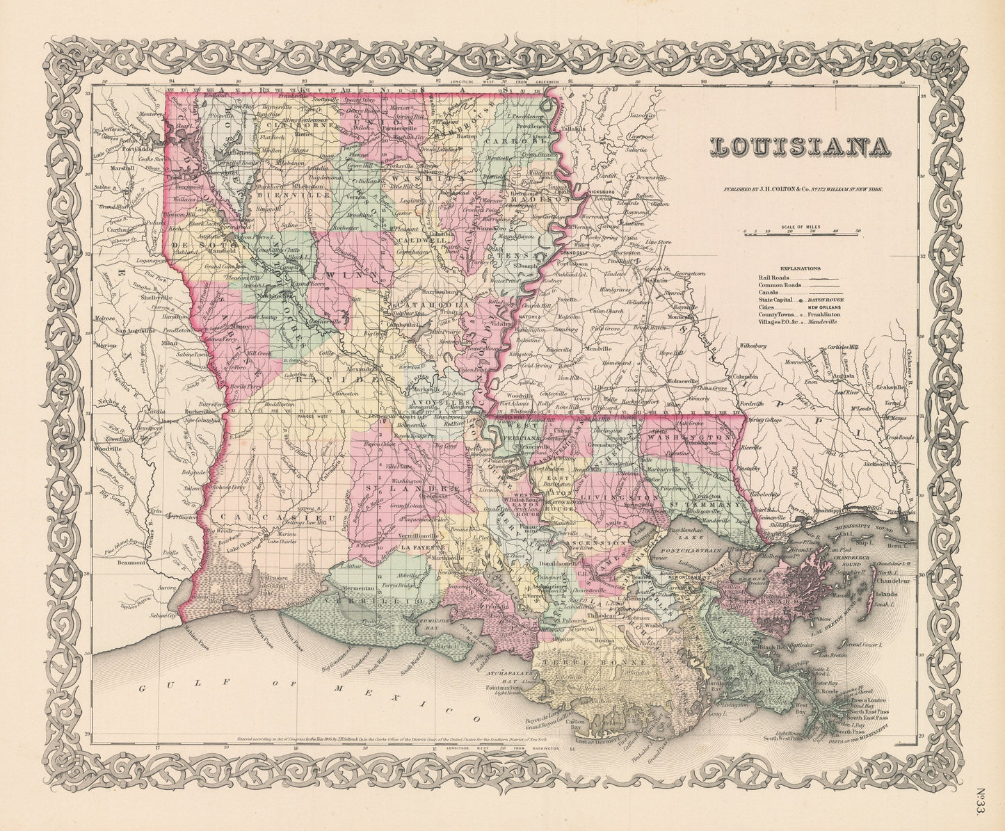
By: Joseph H. Colton
Date of Original: 1856 (published) New York
Original Size: 14 x 17 inches (35.5 x 43.2 cm)
This is a fine print reproduction of a map of Louisiana, published by Joseph H. Colton out of New York in 1856. The map is color coded by county with townships also identified and shows railroads, common roads, rivers, canals, lakes, ports, swamps, large towns and villages of the mid-19th century.
The map also offers great cartographic detail to the mouth of the Mississippi River that leads to New Orleans, Baton Rouge and many northern states and territories of the era. The Mississippi was a vital route of commerce for settlers on what was then the American Frontier.
Inventory #NA132
Share