1
/
van
2
mysite
1856 Wisconsin
1856 Wisconsin
Normale prijs
£289.00 GBP
Normale prijs
£294.00 GBP
Aanbiedingsprijs
£289.00 GBP
Belastingen inbegrepen.
Verzendkosten worden berekend bij de checkout.
Aantal
Kan beschikbaarheid voor afhalen niet laden
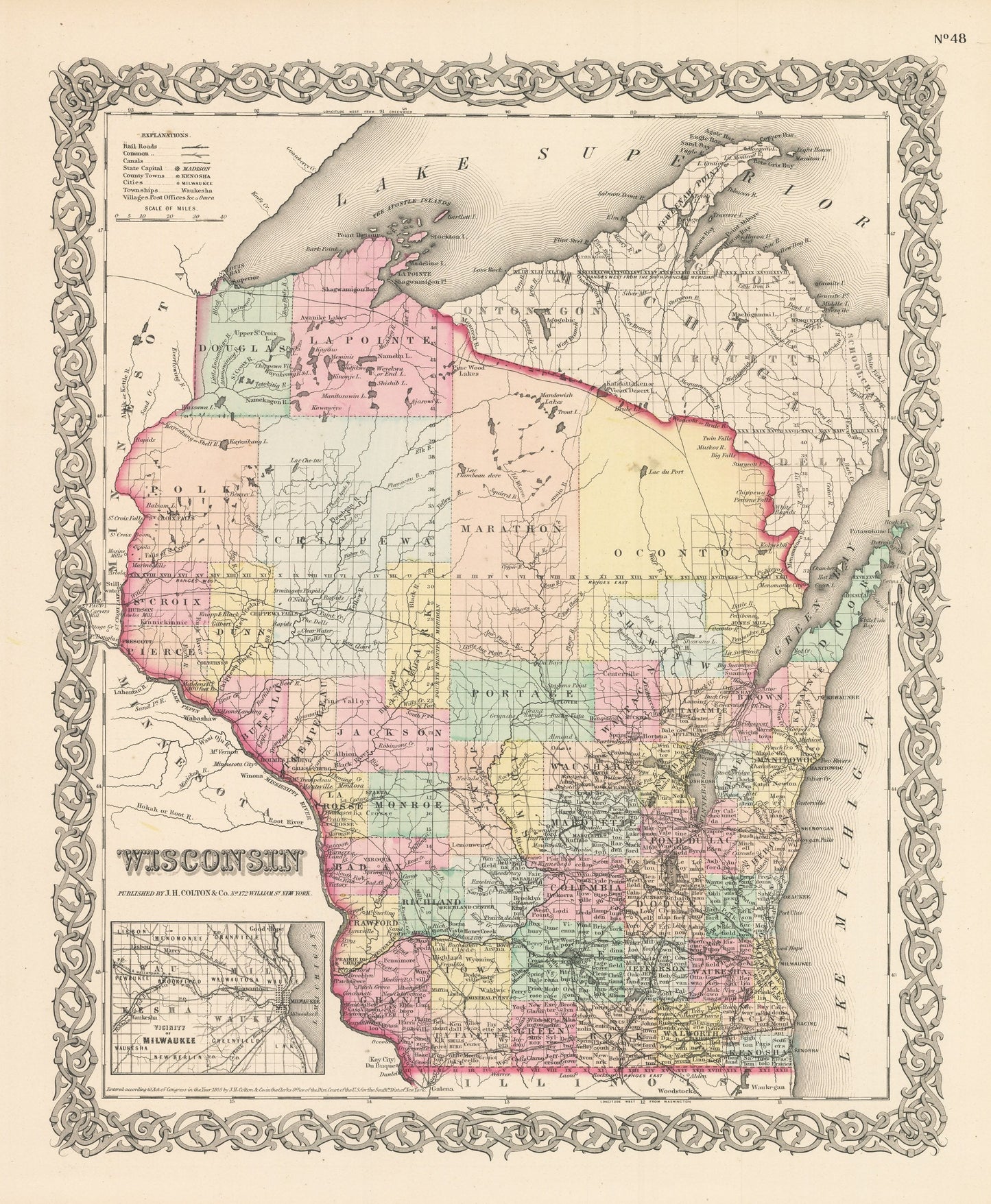
By: Joseph H. Colton
Date of Original: 1856 (published) New York
Original Size:?16 x 13 inches (40.5 x?33 cm)
This is a fine print reproduction of a map of Wisconsin, published by Joseph H. Colton out of New York in 1856.
The map is color coded by county with townships also identified and shows railroads, common roads, rivers, canals, lakes, ports, large towns and villages of the mid-19th century. The map includes a smaller inset map showing the vicinity of Milwaukee. While much of the population resides in the lower half if the state, the large counties of Wisconsin's Northwoods?have yet to be surveyed and?contain little cartographic detail.
Inventory #NA144
Share