1
/
av
1
mysite
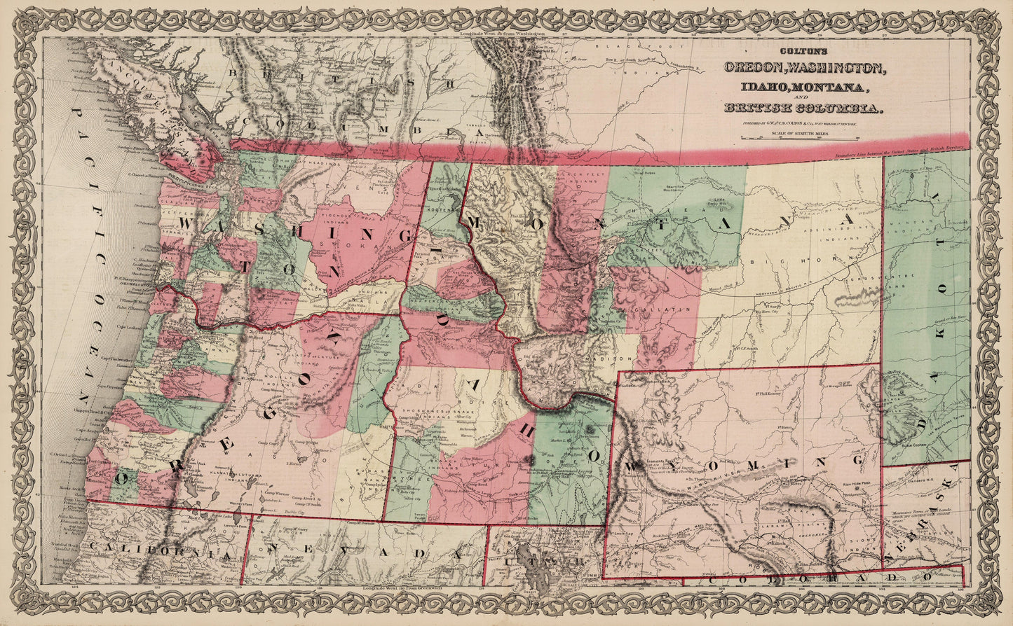
1869 Colton's Oregon, Washington, Idaho, Montana and British Columbia.
1869 Colton's Oregon, Washington, Idaho, Montana and British Columbia.
Ordinarie pris
£369.00 GBP
Ordinarie pris
£374.00 GBP
Försäljningspris
£369.00 GBP
Skatter ingår.
Frakt beräknas i kassan.
Kvantitet
Det gick inte att ladda hämtningstillgänglighet
By: J.H. Colton
Date: 1873 (Published) New York
Dimensions: 16.5 x 27 inches (42 cm x 68.6 cm)
This is a lovely reproduction of a and well-engraved authentic antique hand colored map from ¡®Colton¡¯s General Atlas¡¯. The map identifies counties, territories, cities, towns, roads, railroads and topographical features. The western maps from this period were changing on a year to year basis with the development of the area. This fascinating map visually demonstrates the changes and development of the West at this period in time.
Colton takes pains to describe regional differences with phrases such as ¡®Low rolling hills and fine pasturage for cattle¡¯, ¡®Divide of the waters of the Pacific and Great Basin¡¯, gold and silver mines are duly described, and Indian tribes and the areas populated by them are also indicated, as are missions, forts and trading posts. One final quote is worth mentioning, ¡®The valley of the Yellowstone is spacious, fertile, and salubrious'.
Inventory #19295
Share