1
/
von
1
mysite
1856 Arkansas
1856 Arkansas
Normaler Preis
£289.00 GBP
Normaler Preis
£294.00 GBP
Verkaufspreis
£289.00 GBP
Inkl. Steuern.
Versand wird beim Checkout berechnet
Anzahl
Verfügbarkeit für Abholungen konnte nicht geladen werden
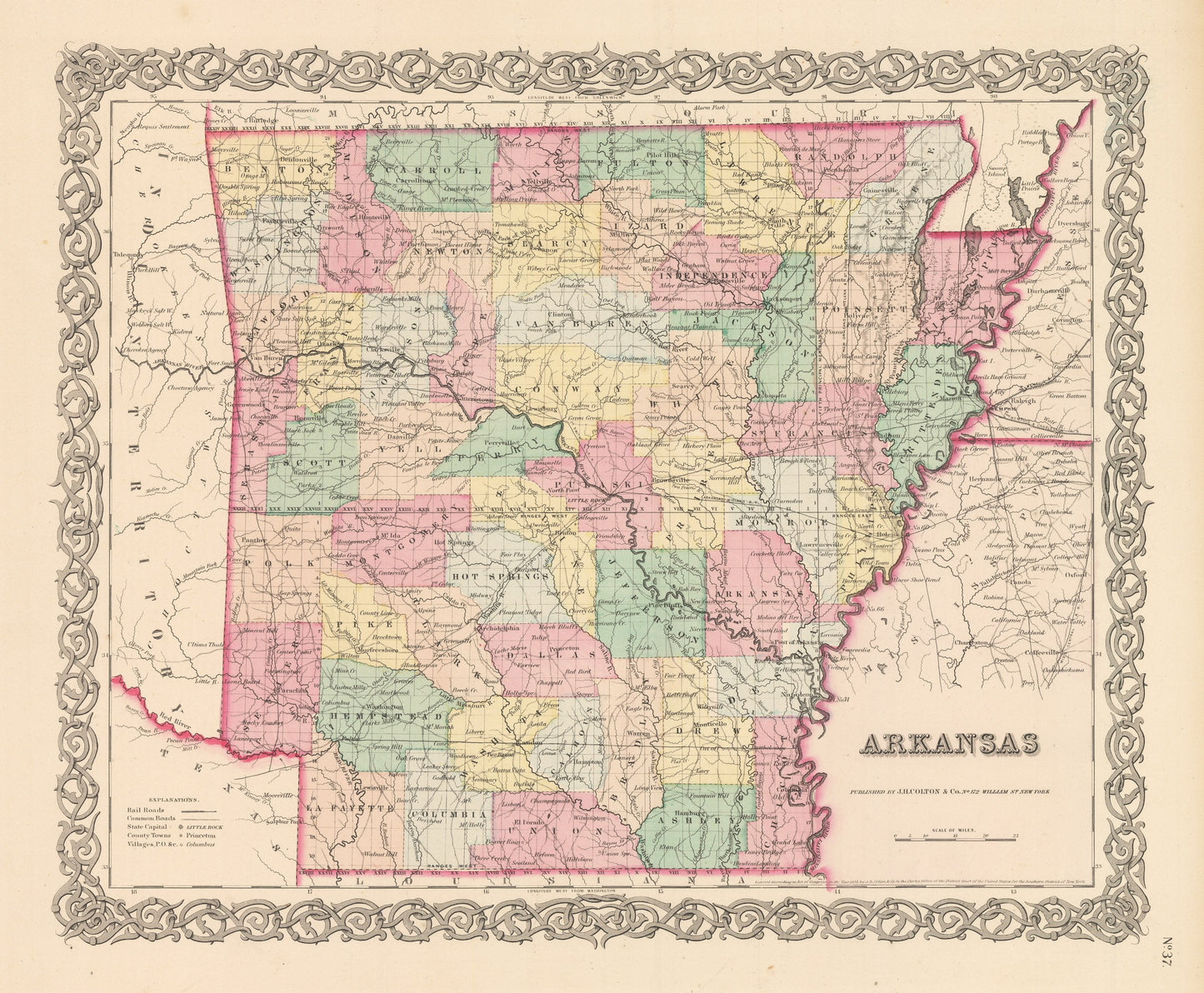
By: Joseph H. Colton
Date of Original: 1856 (published) New York
Original Size: 14 x 17 inches (35.5 x 43.2 cm)
This is a fine print reproduction of a map of Arkansas, published by Joseph H. Colton out of New York in 1856. The map is color coded by county with townships also identified and shows railroads, common roads, rivers, canals, lakes, ports, large towns and villages of the mid-19th century. The map is bordered by Indian Territory to the west, which was home to many eastern tribes forced off their ancestral lands west along the Trail of Tears. This area would one day become Oklahoma.
Inventory #NA134
Share