mysite
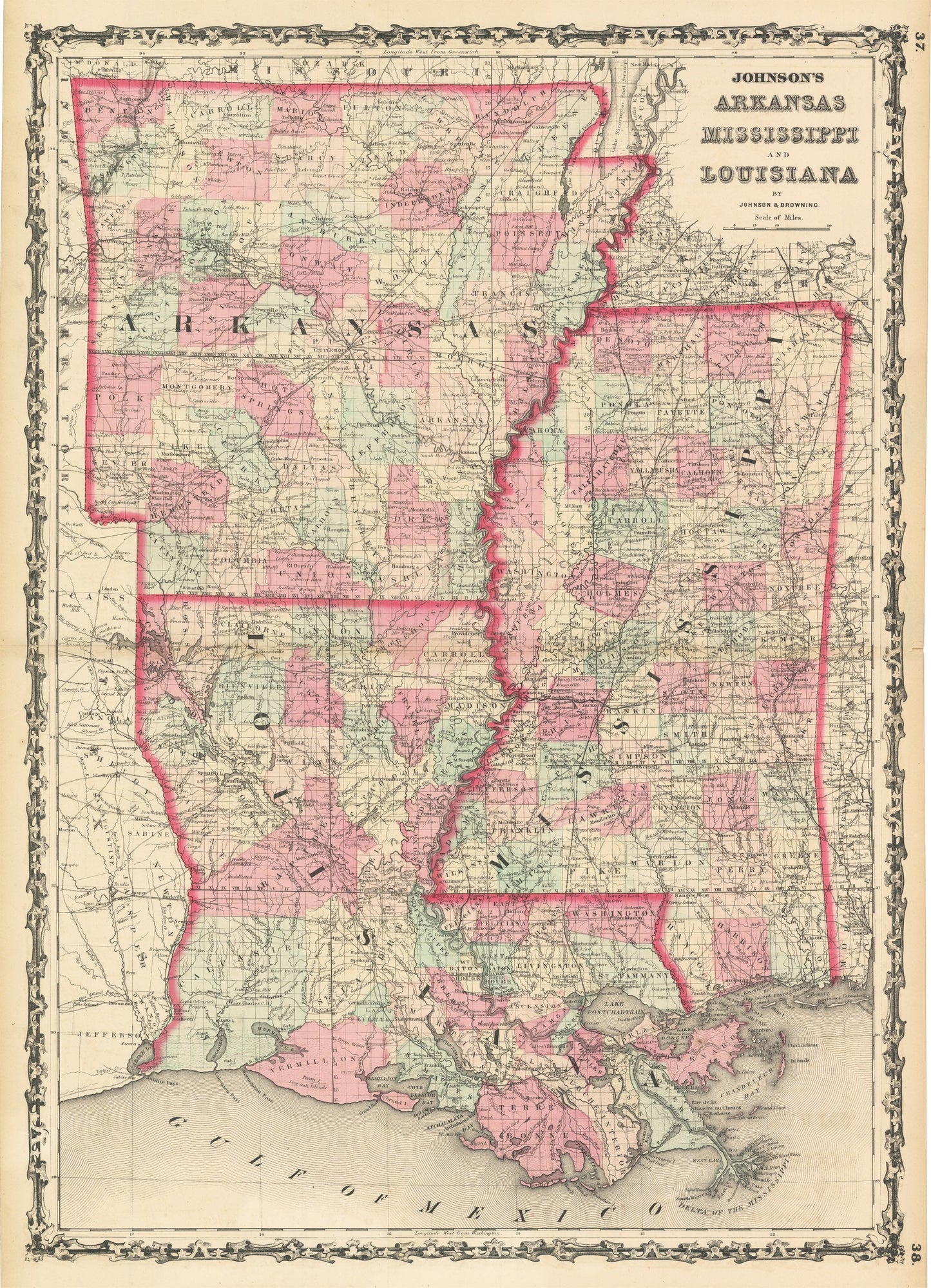
1861 Johnson's Arkansas Mississippi and Louisiana
1861 Johnson's Arkansas Mississippi and Louisiana
Verfügbarkeit für Abholungen konnte nicht geladen werden
By: Johnson and Browning
Date of Original: 1861 (published) New York
Original Size:?25 x 18 inches (63.5 x 45.75 cm)
This is a fine print reproduction of a map of Arkansas, Mississippi, and Louisiana, published by Johnson and Browning out of New York in 1861. The map is color coded by county and shows railroads, wagon roads, rivers, canals, swamps, ports, large towns, and villages of the mid-19th century.
The timing of this map is noteworthy as the American Civil War began that same year and the state presented had since formally seceded from the Union and are therefor Confederate States. A number of important battles would be fought within the region over the coming years.
Inventory #NA134
Share