mysite
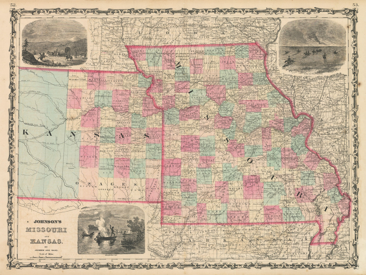
1862 Johnson's Missouri and Kansas
1862 Johnson's Missouri and Kansas
Verfügbarkeit für Abholungen konnte nicht geladen werden
By: Johnson and Ward
Date of Original: 1862 (published) New York
Original Size:?17.5 x 24 inches (44.5 x?61 cm)
This is a fine print reproduction of a map of Missouri and Kansas, published by Johnson out of New York in 1862. The map is color coded by county and shows railroads, wagon roads, rivers, canals, forts, large towns, and villages of the mid-19th century.?Important towns that can be found within the map include?St. louis, Independence, Kansas City, and Lawrence to name a few.
The map is surrounded by three decorative vignettes illustrating a fire on the prairie, Santa Fe from the Great Missouri Trail, and a scene of natives spear fishing along a river edge. Counties and surveyed lands only extend so far into Kansas the rest of which is lacking cartographic detail save for the proposed route of the Pacific Railroad, and the legendary Santa Fe Trail. At the time of printing, much of this land was still in control of the plains tribes.
Inventory #NA147
Share