mysite
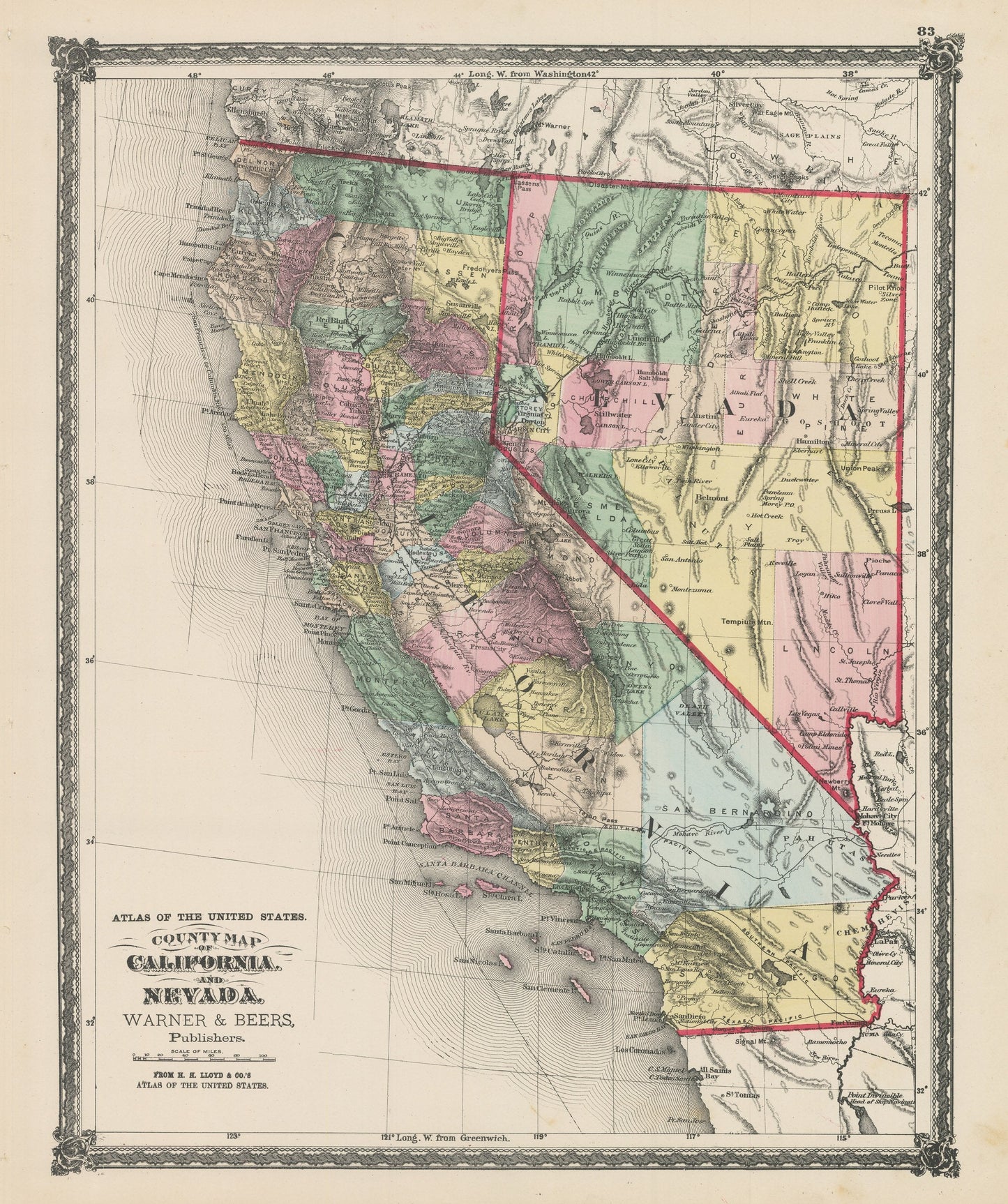
1875 County Map of California and Nevada
1875 County Map of California and Nevada
Verfügbarkeit für Abholungen konnte nicht geladen werden
By: Warner & Beers
Date of Original: 1875 (Published) Chicago
Original Size:?17.5 x?14.5?inches (44.5 x?37 cm)
This is an authentic, Vintage Map Print of?California and Nevada?by Warner & Beers, published out of Chicago in 1875.
The map is?color coded by county and?includes a wealth of interesting historical content and cartographic detail. Much of this region had previously been part of a variety of larger territories such Upper California, New Mexico, and Utah.?Over the years these territories shifted and changed until they became what is known today and displayed in this map from 1875. Many of the counties shown in this map will be further divided and rearranged in years to come.
Interesting cartographic notes include a number of completed railroads in northern and central California connecting to several proposed railroads in Southern California.?Other historical landmarks include military forts and?a wide range of mining towns that are much less significant today.
Inventory #NA160-2
Share