mysite
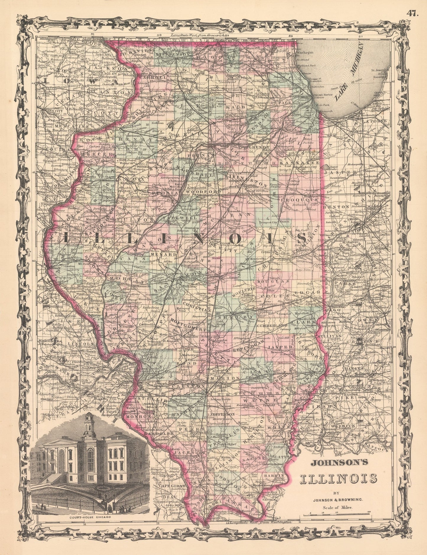
1861 Johnson's Illinois
1861 Johnson's Illinois
Kan beschikbaarheid voor afhalen niet laden
By: Johnson and Ward
Date of Original: 1861 (published) New York
Original Size:?17 x 13 inches (43 x 33 cm)
This is a fine print reproduction of a map of Illinois, published by Johnson and Ward out of New York in 1861. The map is color coded by county and shows railroads, wagon roads, rivers, canals, large towns, and villages of the mid-19th century.?A vignette appears in the lower left corner presenting a view of the court house in Chicago. Important towns such as?Chicago, Peoria, Joliet, Springfield, St. Louis, and the former state capitols of Vandalia and Kaskaskia can be found within the map.
The timing of the publication of this map is noteworthy as the American Civil War had just begun. Abraham Lincoln, lawyer and Illinois Statesman had just been elected as the 16th President of the United States. Additionally, thousands of men?from Illinois would join the union army and a the state would be home to four confederate prisons, in Alton; Camp Butler, in Springfield; Camp Douglas, in Chicago; and Rock Island.
Inventory #NA141
Share