mysite
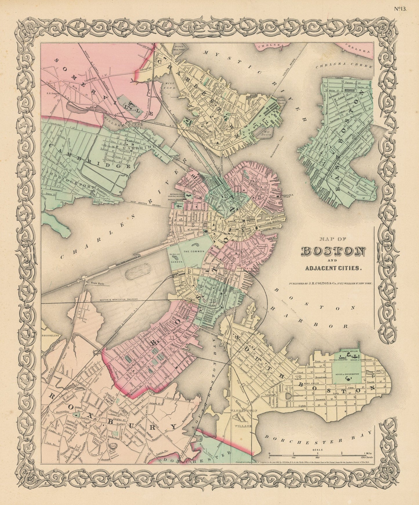
1856 Map of Boston and Adjacent Cities
1856 Map of Boston and Adjacent Cities
Couldn't load pickup availability
By: Joseph H. Colton
Date of Original: 1856 (published) New York
Original Size: 14 x 17 inches (35.5 x 43.2 cm)
This is a fine print reproduction of a map of Boston and the adjacent cities of Charlestown, Somerville, Cambridge, Roxbury, and East and South Boston, published by Joseph H. Colton out of New York in 1856. The map is color coded by?towns and wards and includes street names, railroads, parks, gardens, and important buildings.?
This particular example was published before the Back Bay reclamation project that would further expand the land area of Boston. Since plans for the project were well known to Colton, a light street grid can be found traced over the water. Today the area is home to the Commonwealth Avenue Mall, the Boston Public Library, and a wide?array of retail shops, restaurants, and hotels.?
Inventory #NA113
Share