mysite
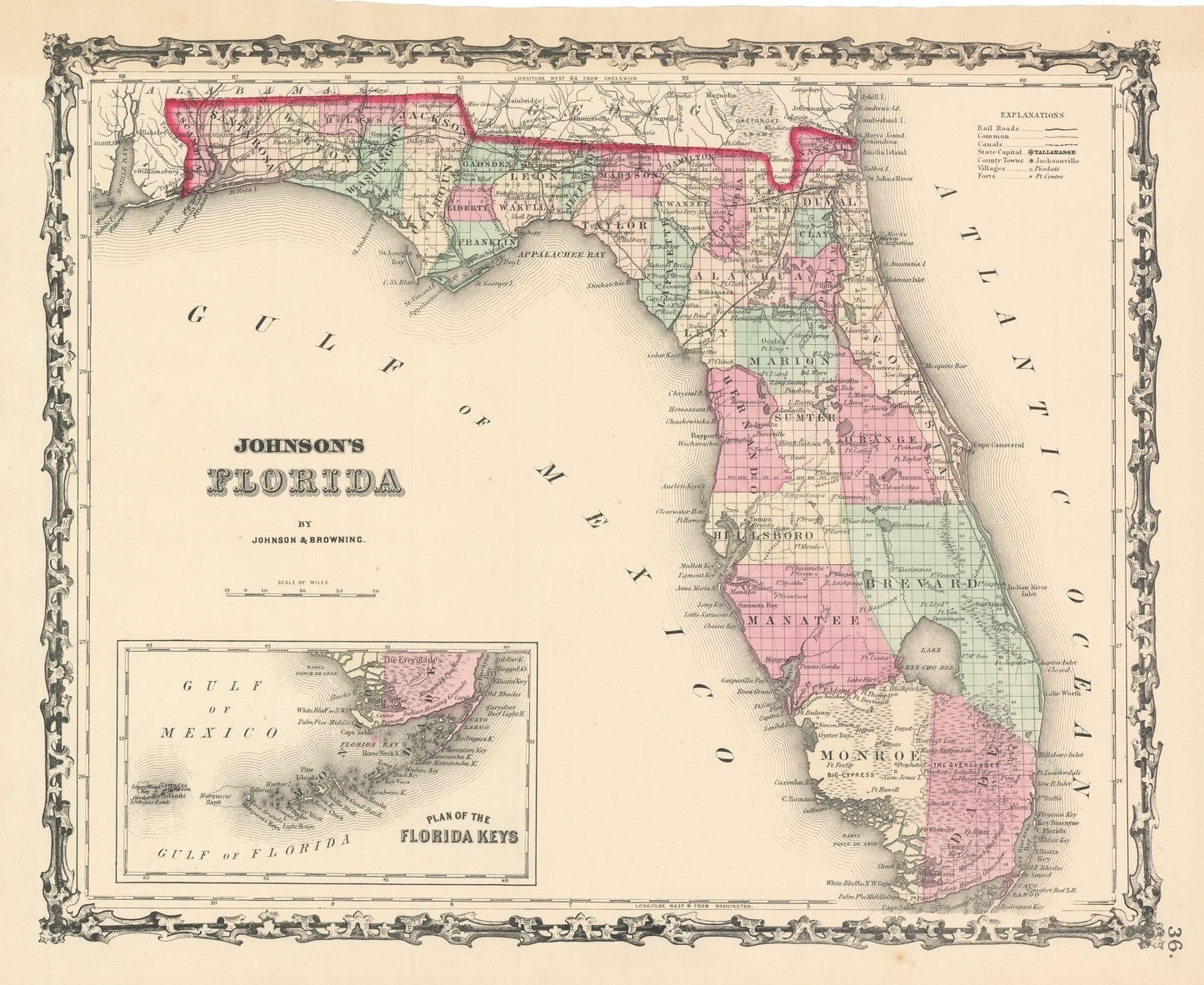
1861 Johnson's Florida | Plan of the Florida Keys
1861 Johnson's Florida | Plan of the Florida Keys
Couldn't load pickup availability
By: Johnson and?Browning
Date of Original: 1861 (published) New York
Original Size: 12.5 x 16 inches (31.75 x 40.5 cm)
This is a fine print reproduction of a map of?Florida and the Florida Keys, published by Johnson and Browning out of New York in 1861. The map is color coded by county and shows railroads, wagon roads, rivers, canals, ports, larger towns, and villages of the mid-19th century.
At the time of publication, nearly half of the state was still unsettled and had yet to be surveyed. Much of the population was in the northern portion of the state bordering Georgia, and Alabama with Tallahassee and Jacksonville being the largest towns. In the south there are notes such a Big Cypress, which is now a national preserve Mangrove & Pine Woods, and Indian Hunting Grounds.?In the lower left is an inset map of the Florida Keys from Biscayne Bay to the Tortugas Islands.
Inventory #NA130
Share