mysite
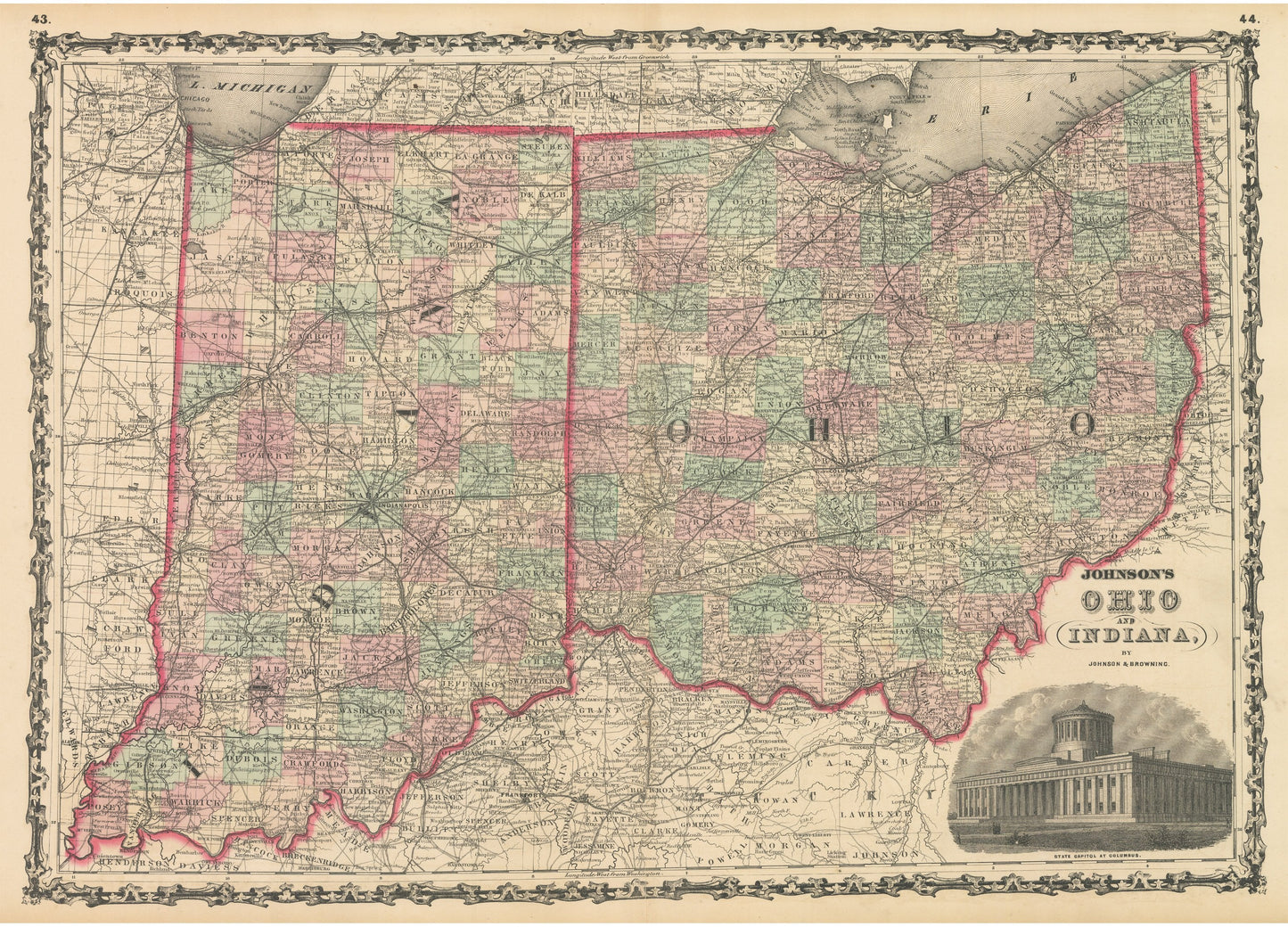
1861 Johnson's Ohio and Indiana
1861 Johnson's Ohio and Indiana
Couldn't load pickup availability
By: Johnson and Ward
Date of Original: 1861 (published) New York
Original Size:?17.5 x 24 inches (44.5 x?61 cm)
This is a fine print reproduction of a map of Ohio and Indiana, published by Johnson and Ward out of New York in 1861. The map is color coded by county and shows railroads, wagon roads, rivers, canals, ports, large towns, and villages of the mid-19th century.?A vignette appears in the lower right corner presenting a view of the state capitol building of Ohio in Columbus. Important towns such as Cleveland, Toledo, Columbus, Cincinnati, Fort Wayne, Indianapolis, and Evansville can be found within the map.
The timing of the publication of this map is noteworthy as the American Civil War had just begun and?the railroad infrastructure already in place in Ohio and Indiana would serve of great benefit and provide an advantage to the Union Army.?
Inventory #NA138
Share