mysite
1852 A New Map of the State of Iowa
1852 A New Map of the State of Iowa
Couldn't load pickup availability
By:?Thomas Cowperthwait & Co.
Date of Original:?1852 (published) Philadelphia
Original Size:?13 x 16?inches (33 x?40.5?cm)
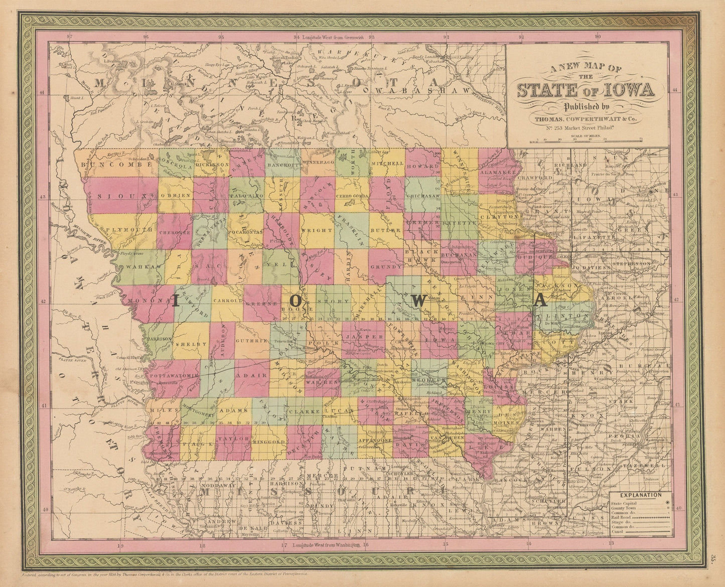
This is a fine print reproduction of Iowa, published by Thomas Cowperthwait and Co. out of Philadelphia in 1852 just under six?years after Iowa was officially admitted into the Union. The map is color coded by county with towns, rivers, lakes, wagon roads, canals and railroads noted throughout.
Much of the northwestern portion of the state has yet to be?surveyed but was divided into equal size counties that were still?occupied by Native Americans. Many of the counties are entirely uncivilized and are named after Native American people and tribes. Some such county names include Pocahontas, Cherokee, Sac, Fox, Sioux, Winnebago, Pottawatomie, and Chickasaw.?Additionally, the land to the west of Iowa is still part of a large Indian Territory that would shrink considerably in the coming years.??
Inventory #NA146-2
?
Share