mysite
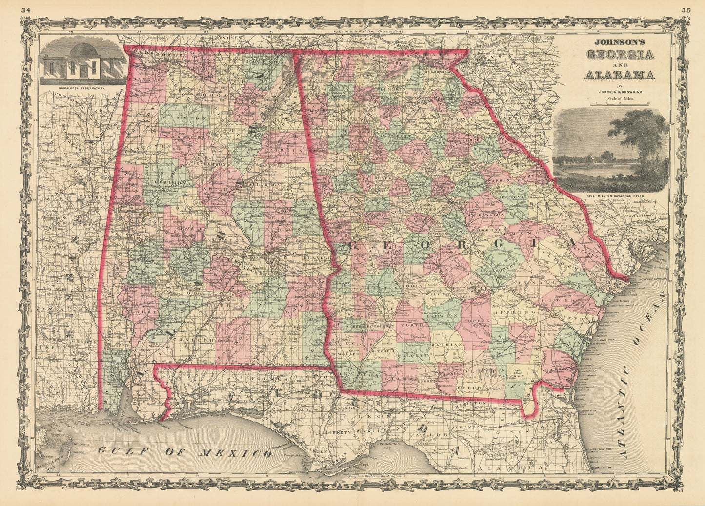
1861 Johnson's Georgia and Alabama
1861 Johnson's Georgia and Alabama
Det gick inte att ladda hämtningstillgänglighet
By:?Johnson and Browning
Date of Original:?1861 (published) New York
Original Size:?18 x 24 inches (35.5 x 43.2 cm)
This is a fine print reproduction of a map of?Georgia and Alabama?published by Johnson and Browning out of New York in 1861. The map is color coded by county and shows railroads, wagon roads, rivers, canals, ports, large towns, and villages of the mid-19th century. On either side of the map are vignettes of a rice mill on the Savannah River and the Tuscaloosa Observatory.?
The timing of the publication of this map is noteworthy as Georgia and Alabama had seceded from the United States and are therefor Confederate States. A large number of battles would be fought during the Civil War within these states, most of them occurring between the years 1862 and 1864.
Condition:?This map is in A condition with bold original color on fine paper with ample margins on all sides. Some light paper toning is apparent along the edge of the paper. A small centerfold separation exists at bottom center
Inventory #NA127
Share