mysite
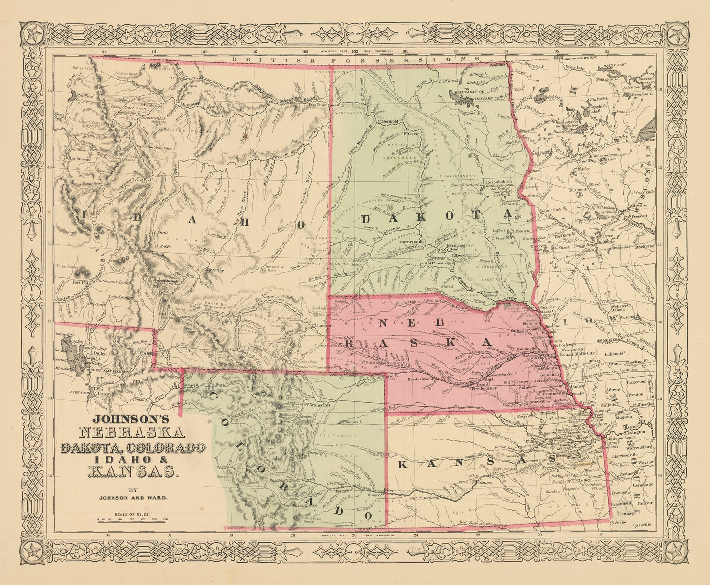
1863 Johnson's Nebraska, Dakota, Colorado, Idaho & Kansas
1863 Johnson's Nebraska, Dakota, Colorado, Idaho & Kansas
Det gick inte att ladda hämtningstillgänglighet
By:?Johnson & Ward
Date of Original: 1862 (published) New York
Original Size: 13 x 16.5 inches (33 x 42 cm)
This is an Gicl¨¦e Map Print Reproduction of the territories of Nebraska, Dakota, Colorado and Idaho as well as the state of Kansas. It was published in 1862 by Alvin J. Johnson. This is the first map to present the territory of Idaho, which in this case extends as far east to border Nebraska and Dakota.?Much of this land would one day become Wyoming, and Montana.
The map provides great historic content?with regards?to the Native American tribes that once dominated the region. Various Sioux bands as well as tribes like the Crow, Arapaho, and Cheyenne can be found within the map. Many railroads both completed and proposed are delineated throughout the map and several historic military forts can also be found.?
Inventory #NA149
Share