mysite
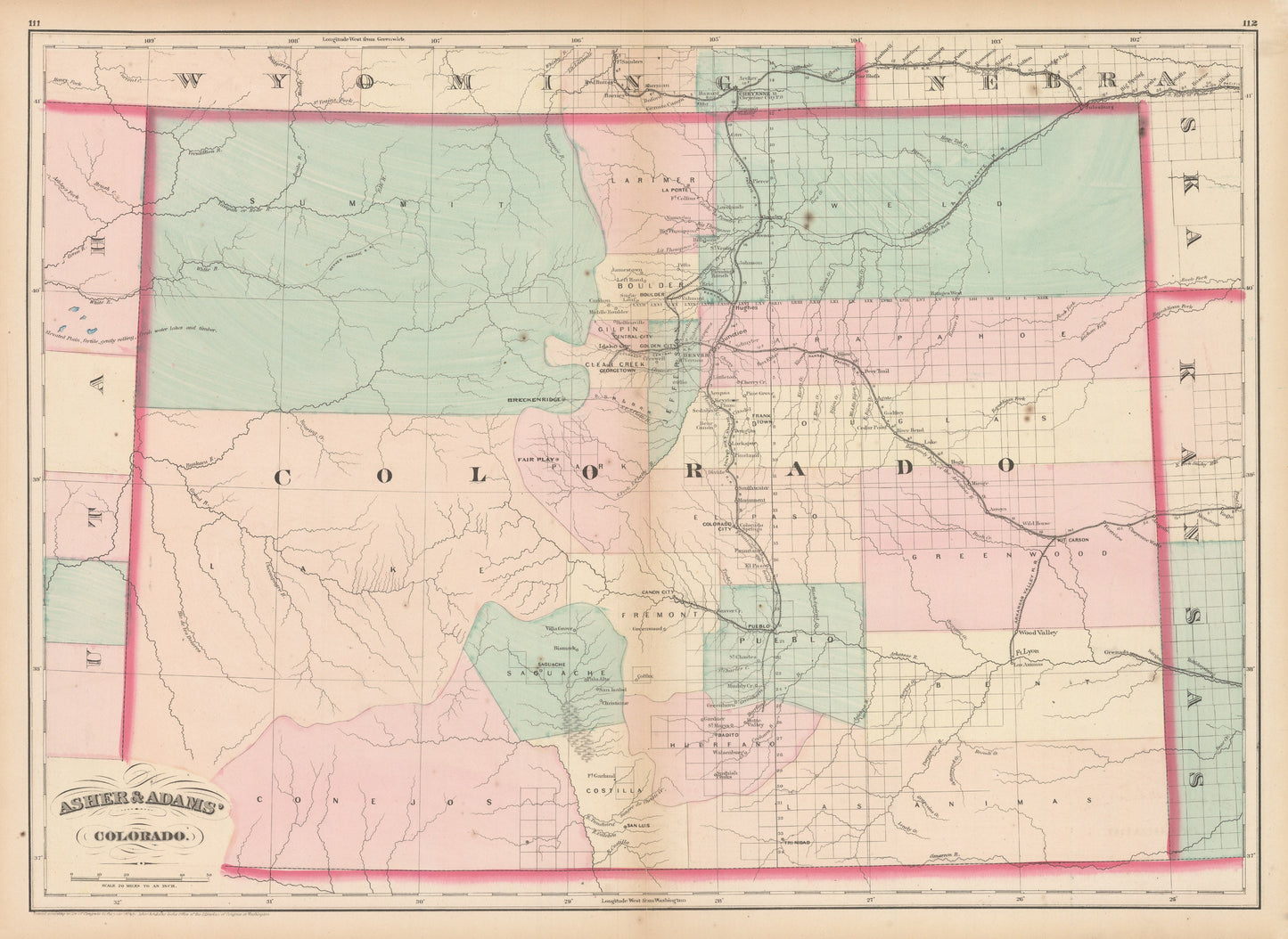
1874 Asher & Adams Colorado
1874 Asher & Adams Colorado
Det gick inte att ladda hämtningstillgänglighet
By: Asher & Adams
Date of Original: 1874 (Published) New York
Original Size: 16.5 x 22.5 inches (42 cm x 57.15 cm)
This is a fine print reproduction of a large format map of Colorado detailing surveyed land and the network of railroads during the mid 1870s.?Cartographic detail?includes established cities, mining towns,?military forts, and the delineation of mountain river systems with no attention paid to the topography of the Rocky Mountains. Breckenridge is shown within a Summit County that encompasses the entire northwest portion of the state. Many of these large counties would be broken up and reconfigured as more miners and settlers moved in establishing many new towns along the way.
Asher & Adams was one of the first United States atlases to exclusively feature railroad lines, showing minimal topography. This later edition show more topographical features than did earlier editions. Only towns that were near or on the railroad lines were featured in earlier editions.?
Inventory #NA154
Share