mysite
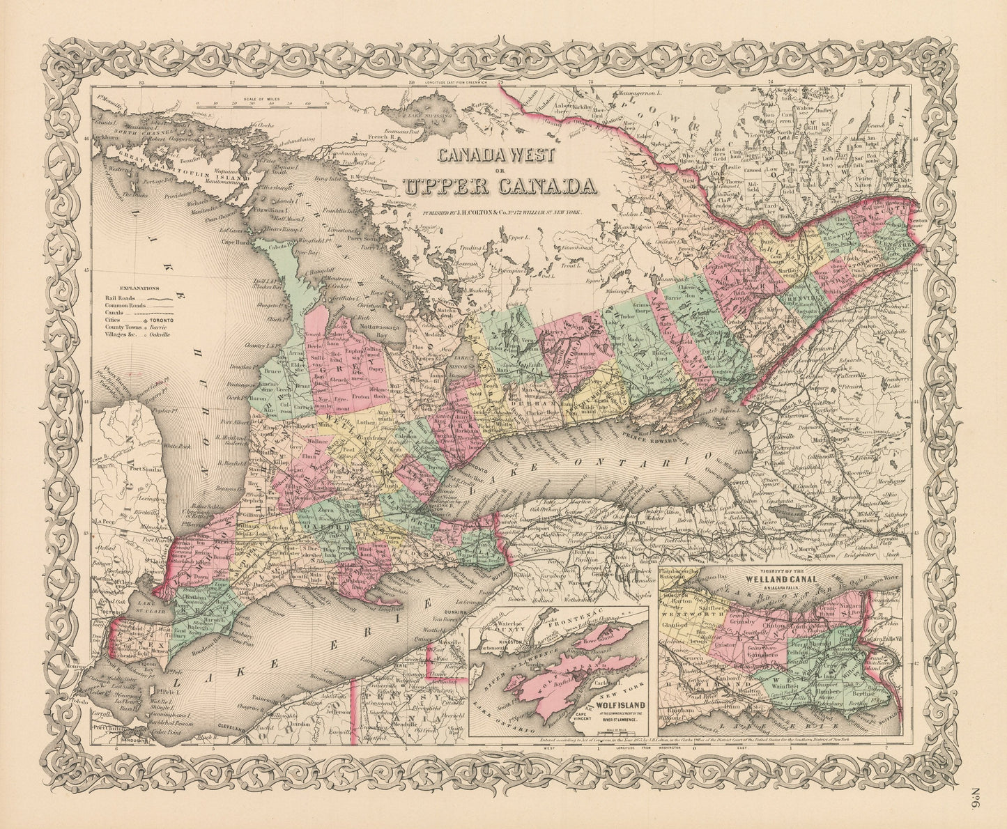
1856 Canada West or Upper Canada
1856 Canada West or Upper Canada
Nie można załadować gotowości do odbioru
By:?Joseph H. Colton
Date of Original:?1856 (published) New York
Original Size:?14 x 17 inches (35.5 x 43.2 cm)
This is a fine print reproduction of a map of?the most populous region of Canada, known then as Canada West or Upper Canada and is known today as Ontario. The map was published by?Joseph H. Colton?out of New York in 1856.?
The map?is color coded by county with townships also identified and shows railroads, wagon roads, canals, rivers, ports, and towns of the mid-19th century. Two small inset maps include the vicinity of the Welland Canal & Niagara Falls and Wolf Island between New York and County Frontenac. Important?Canadian cities such a Toronto and Hamilton, are shown as are the American cities of Detroit, Cleveland, Buffalo, and Rochester.?
Inventory #NA102
?
Share