mysite
1861 Johnson's New Military Map of the United States...
1861 Johnson's New Military Map of the United States...
Nie można załadować gotowości do odbioru
?
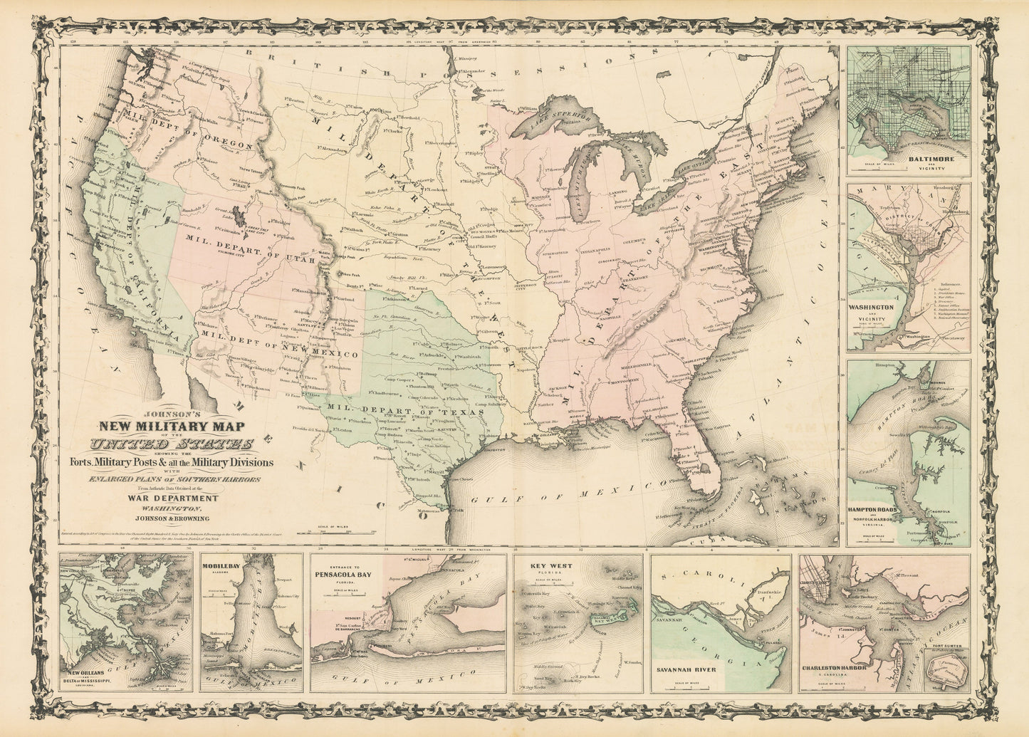
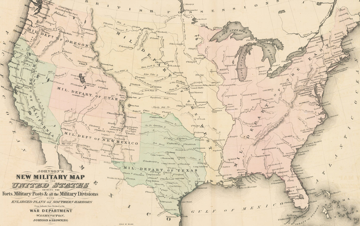
Johnson's New Military Map of the United States Showing the Forts Military Posts & All the Military Divisions with Enlarged Plans of Southern Harbors from Authentic Data Obtained at the War Department
By:?Johnson & Browning
Date of Original: 1862 (published) New York
Original Size: 17 x 24 inches (43 x?61 cm)
This is a fine print reproduction of a?military map of the United States published by Johnson ad Browning out of New York in 1861.
The map presents the United States divided in military departments showing all forts and outposts at the start of the Civil War,?based on information from the United States' War Department
In addition the map includes a number of detailed inserts showing New Orleans and the delta of the Mississippi River, Mobile Bay, entrance to Pensacola Bay, Key West, the Savannah River, Charleston harbor with a plan of Fort Sumter, Hampton Roads and Norfolk Harbor, Washington D.C., and Baltimore.?
Inventory #NA105
?
Share