mysite
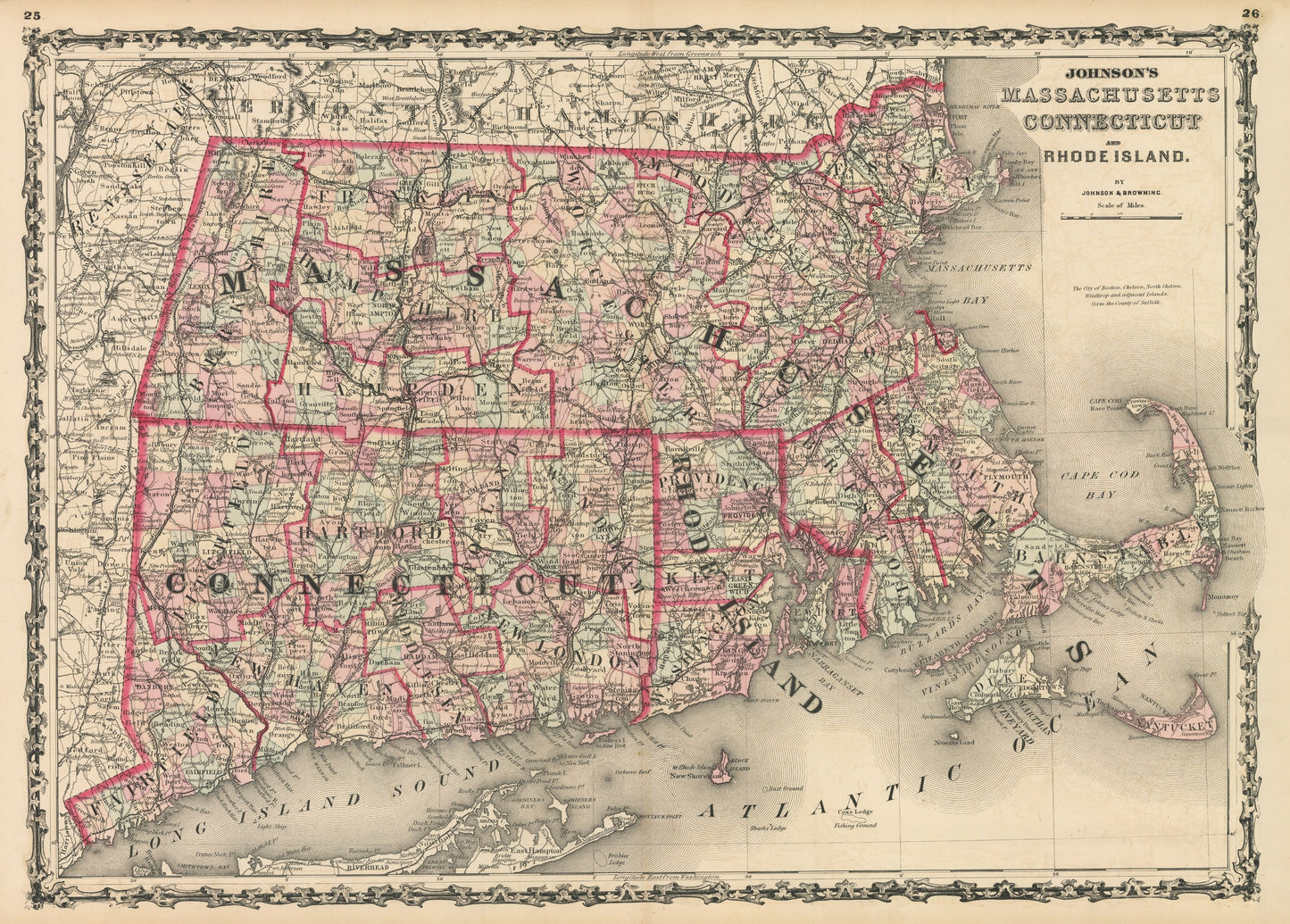
1861 Johnson's Massachusetts Connecticut and Road Island
1861 Johnson's Massachusetts Connecticut and Road Island
Cena regularna
£369.00 GBP
Cena regularna
£374.00 GBP
Cena promocyjna
£369.00 GBP
Z wliczonymi podatkami.
Koszt wysyłki obliczony przy realizacji zakupu.
Ilość
Nie można załadować gotowości do odbioru
By: Johnson and Browning
Date of Original: 1861 (published) New York
Original Size:?17.5 x 24 inches (44.5 x?61 cm)
This is a fine print reproduction of a map of?Massachusetts, Connecticut, and Rhode Island,?published by Johnson and?Browning out of New York in 1861. The map is color coded by county and shows railroads, wagon roads, rivers, canals, ports, major cities and villages of the mid-19th century. Notable places of interest include Cape Cod, Martha's Vineyard, Boston, Newport, Portland, and New Haven to name a few.
Inventory #NA111
Share