mysite
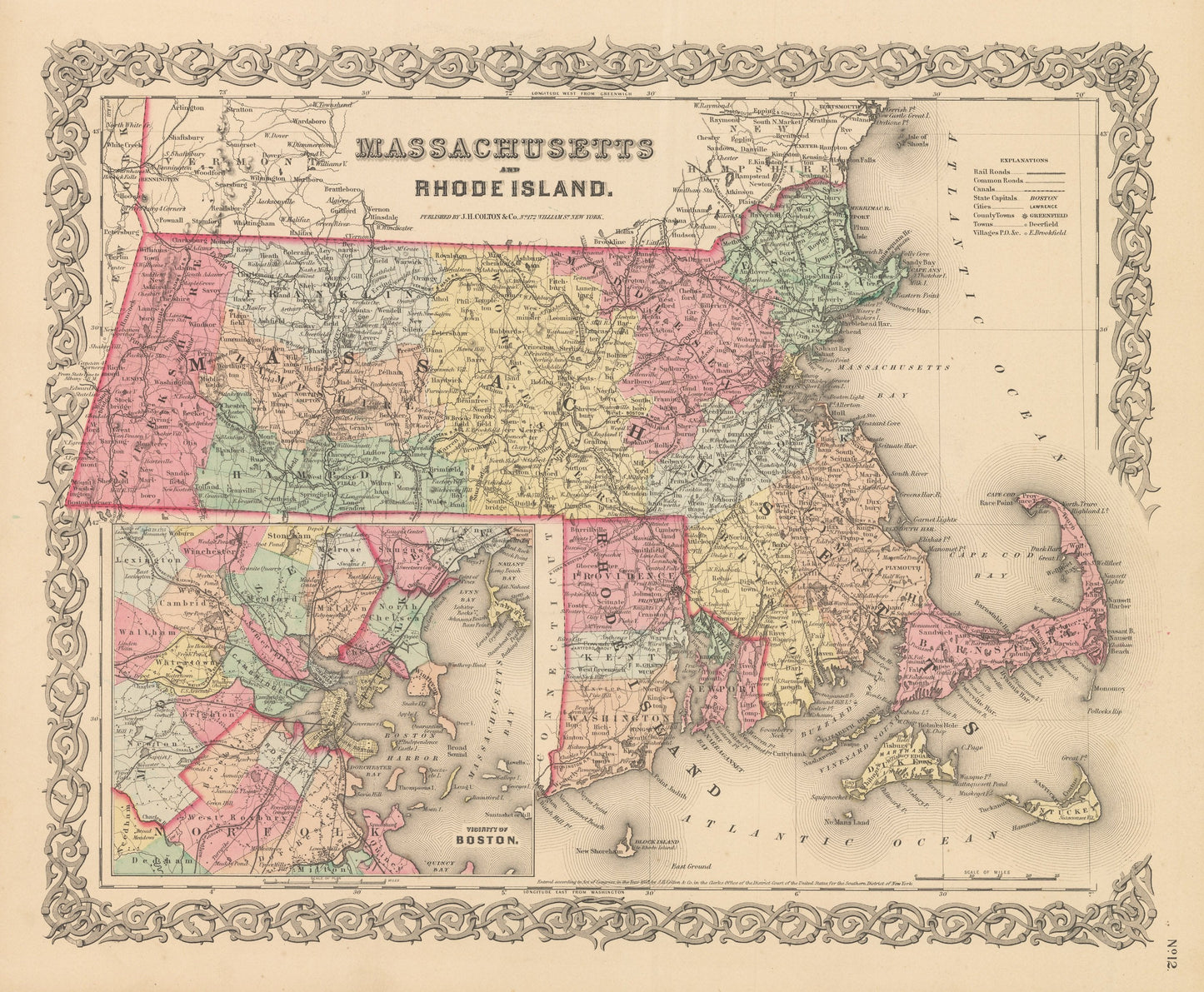
1856 Massachusetts and Rhode Island
1856 Massachusetts and Rhode Island
Cena regularna
£289.00 GBP
Cena regularna
£294.00 GBP
Cena promocyjna
£289.00 GBP
Z wliczonymi podatkami.
Koszt wysyłki obliczony przy realizacji zakupu.
Ilość
Nie można załadować gotowości do odbioru
By: Joseph H. Colton
Date of Original: 1856 (published) New York
Original Size: 14 x 17 inches (35.5 x 43.2 cm)
This is a fine print reproduction of a map of Massachusetts and Rhode Island, published by Joseph H. Colton out of New York in 1856. The map is color coded by county with townships also identified and shows railroads, common roads, rivers, canals, ports, lakes, large towns and villages of the mid-19th century. Included in the lower left if an inset map of the vicinity of Boston extending far enough out to include the counties of Lynn, Lexington, Dedham, and Quincy.?
Inventory #NA112
Share