mysite
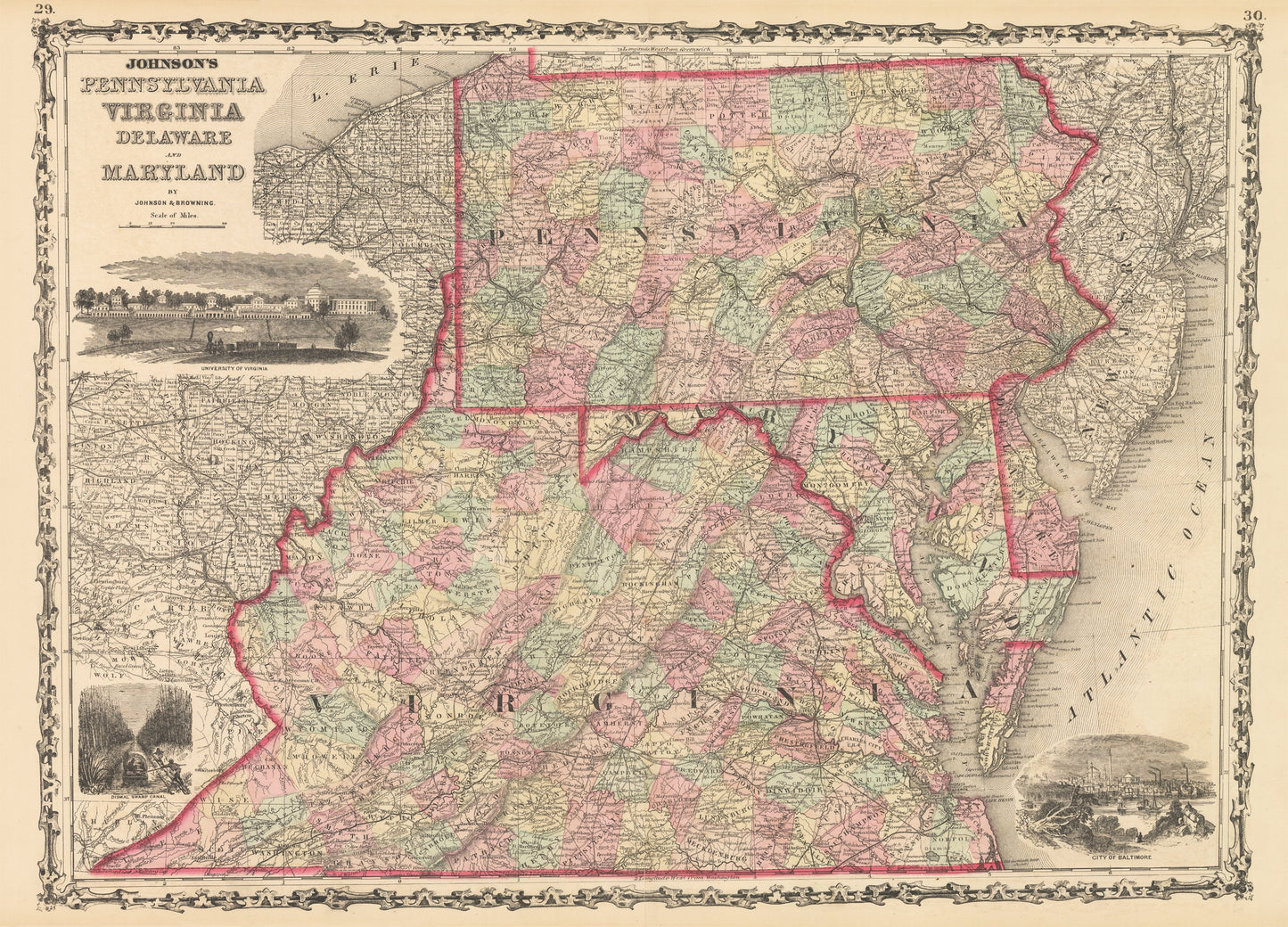
1861 Johnson's Pennsylvania Virginia Delaware and Maryland
1861 Johnson's Pennsylvania Virginia Delaware and Maryland
Nie można załadować gotowości do odbioru
By: Johnson and?Browning
Date of Original: 1861 (published) New York
Original Size: 18 x 25 inches (45.75 x?63.5 cm)
This is a fine print reproduction of a map of Pennsylvania Virginia Delaware and Maryland published by Johnson and Browning out of New York in 1861. The map is color coded by county with townships also identified and shows railroads, wagon roads, rivers, canals, mountains, ports, large towns, and villages of the mid-19th century. The map is embellished with lovely vignettes of the University of Virginia, the Dismal Swamp Canal, and the City of Baltimore.?The time of printing is worth noting as the American Civil War has just officially begun and many bloody battles would be fought in the region.
Inventory #NA117
Share