mysite
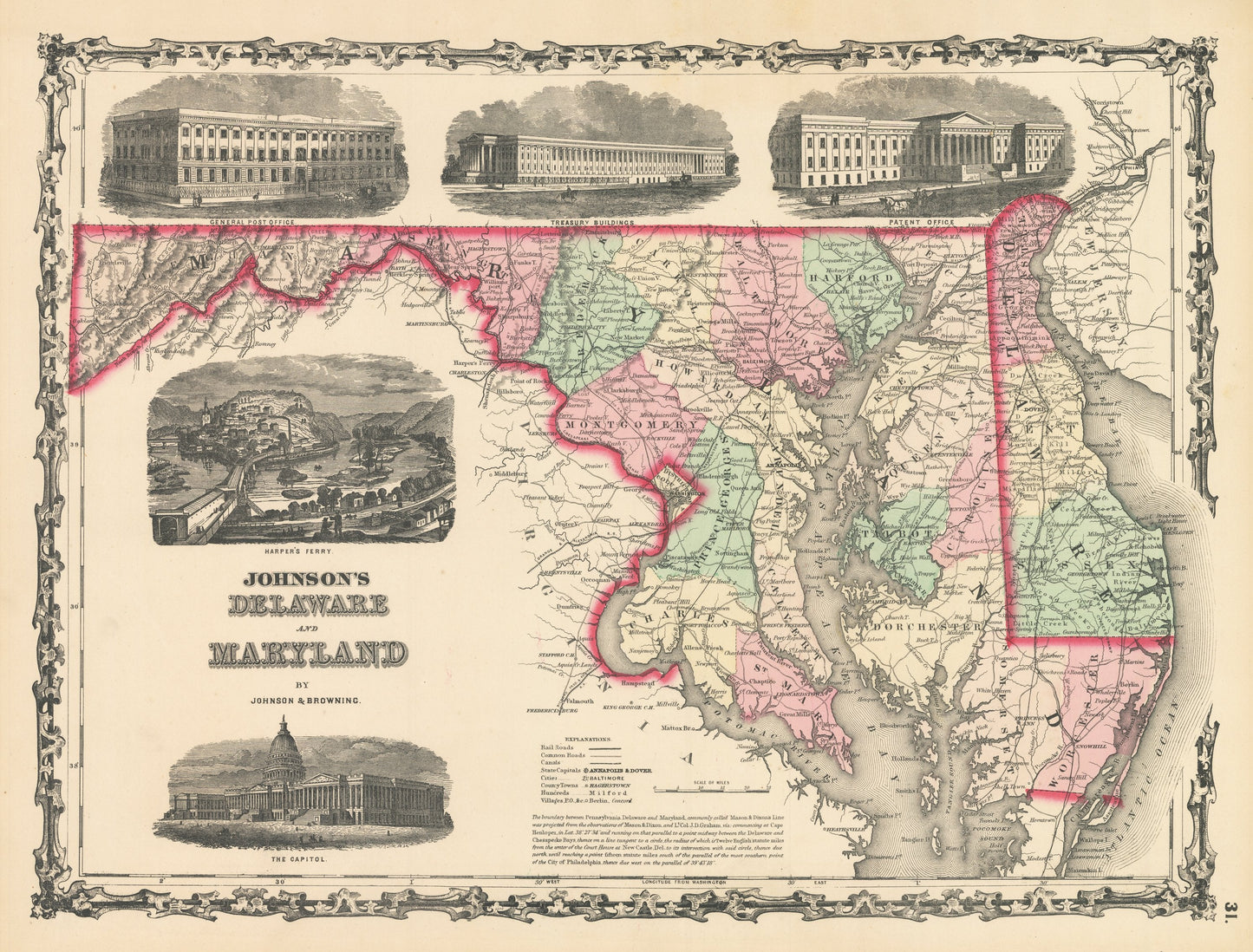
1861 Johnson's Delaware and Maryland
1861 Johnson's Delaware and Maryland
Nie można załadować gotowości do odbioru
By: Johnson and?Browning
Date of Original: 1861 (published) New York
Original Size: 14 x 17 inches (35.5 x 43.2 cm)
This is a fine print reproduction of a map of Maryland and Delaware, published by Johnson and Browning out of New York in 1861. The map is color coded by county and shows railroads, wagon roads, rivers, canals, ports, large towns, and villages of the mid-19th century.
A series of vignettes surrounding the map include views of the Patent Office, Treasury Building, General Post Office, the United States Capitol Building, and Harper's Ferry. Text at the bottom of the map explains the origins of the Mason & Dixon Line that establishes the boundary between Pennsylvania, Delaware, and Maryland.
Inventory #NA121-2
Share