mysite
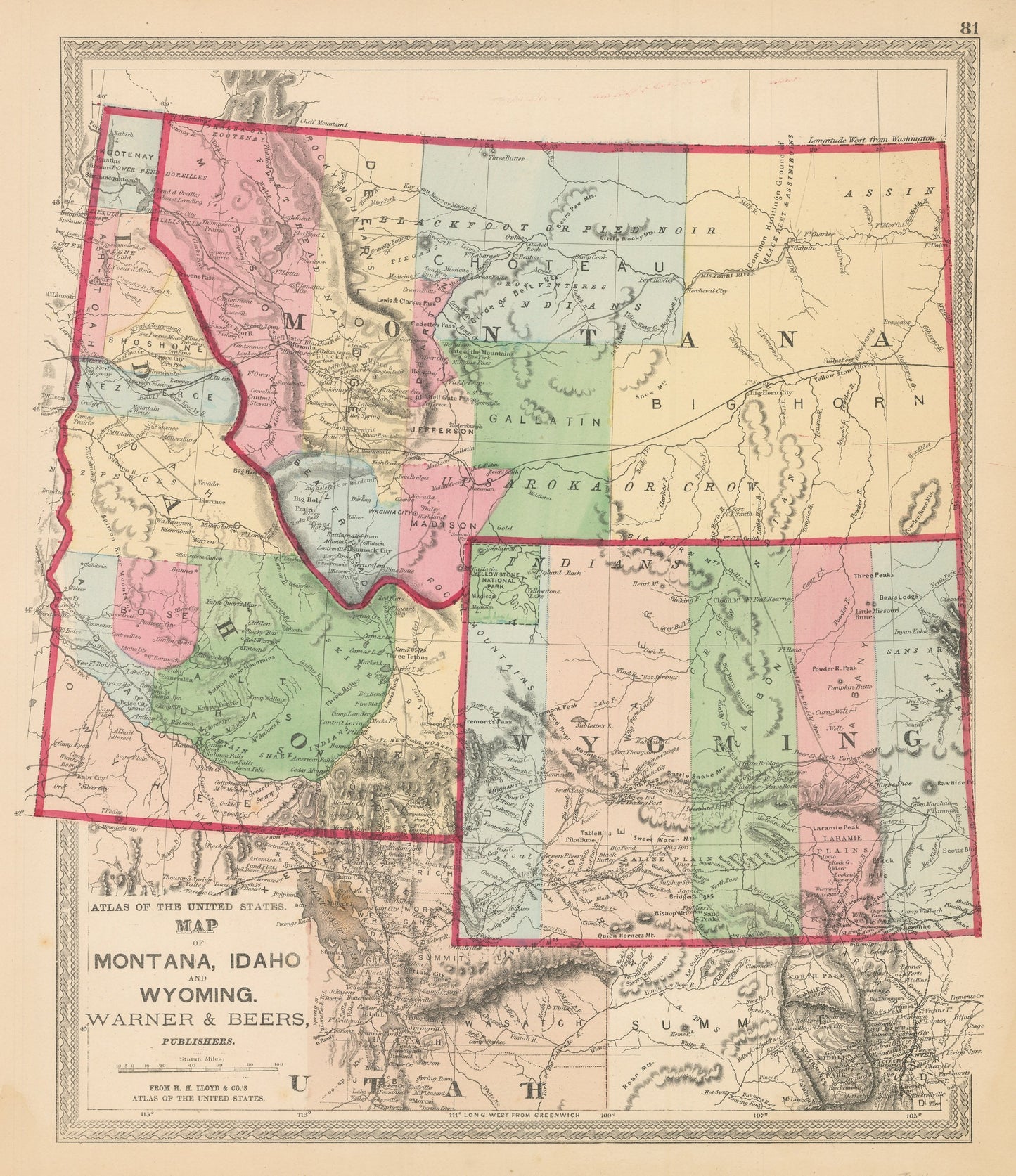
1872 Map of Montana, Idaho, and Wyoming
1872 Map of Montana, Idaho, and Wyoming
Nie można załadować gotowości do odbioru
By: Warner & Beers
Date of Original: 1872 (Published) Chicago
Original Size: 17 x 14.75 inches (43 cm x 37.5 cm)
This is a vintage map reproduction of?Montana, Idaho, and Wyoming by Warner & Beers, published out of Chicago in 1872.
The map is?color coded by county and?includes a wealth of interesting historical content and cartographic detail. Much of this region had previously been part of a variety of territories including the Nebraska, Dakota, and Idaho territory. In this map it is show in its present-day configuration, but still with many large counties that will one day be divided up and reconfigured.?
Interesting cartographic notes include the locations of several Native American tribes including the Crow, Snake, New Perce, and the hunting ground of the Black Feet and Assiniboins. The Oregon Trail is delineated through the map but labeled New Worked Emigrant Road.?Other historical landmarks include Fremont's Pass, Lewis and Clarke's Pass, the gold mining town of Virginia City, a number of frontier military forts and outposts, and Yellowstone National Park, which was established the same year this map was published.?
Inventory #NA150-2
Share