mysite
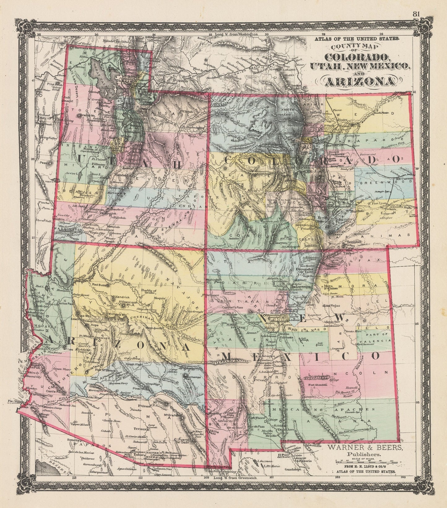
1875 County Map of Colorado, Utah, New Mexico, and Arizona
1875 County Map of Colorado, Utah, New Mexico, and Arizona
Nie można załadować gotowości do odbioru
By: Warner & Beers
Date of Original: 1875 (Published) Chicago
Original Size:?16.5 x?14.5?inches (42 x?37 cm)
This is a fine print reproduction of?the four-corners states, Colorado, Utah, New Mexico, and Arizona by Warner & Beers, published out of Chicago in 1875.
The map is?color coded by county and?includes a wealth of interesting historical content and cartographic detail. Much of this region had previously been part of a variety of larger territories such a New Mexico and Utah, Over the years these territories shifted and changed until they became what is known today and displayed in this map from 1875. Many of the counties shown in this map will be further divided and rearranged in years to come.
Interesting cartographic notes include the locations of several Native American tribes including the Navajo, Pueblo, Apaches,?Mojaves, Tontos, and?Capote to name a few.?Completed railroads in Colorado extend into proposed railroads that would one day run through New Mexico and Arizona.?Other historical landmarks include several military forts and outposts, silver and copper mines, the site of the Massacra of Captain Gunnison, and the updated delineation of the Colorado River through the Grand Canyon from the Powell expedition of 1869.
Inventory #NA158
Share